Within the Blantyre side, the reserve includes Redlees and Priory Bing, as well as woodland along the Clyde and the Rotten Calder. The council's management statement records broadleaved woodland, open water and varied grassland, and notes the role of Priory Bing as both former industrial ground and habitat. Its species observations include woodland plants, orchids, birds, otters, deer, badgers and bats. The associated site surveys are dated, including a 2006 flora survey; they provide a baseline rather than a present-day species census.
The reserve’s landscape is a record of successive land uses. The council’s management statement reports that most surrounding land was farmed before industrialisation. It identifies an 1842 map depiction of accommodation associated with Blantyre Farm on land now occupied by plantation woodland near National Cycle Route 74; by the end of the Second World War that landscape had been replaced by a large colliery and slag heap. Priory Bing’s spoil and disused workings remained visible into the late 1960s. At Redlees, a sandstone quarry and wartime anti-aircraft battery preceded recreation and woodland restoration. These are the council’s historical-map interpretation and management account, not a fresh survey of every feature. Council management statement
Ecologically, the site forms part of a wider Clyde and Rotten Calder network. The council identifies broadleaved riparian woodland, semi-improved grassland, meadow and tall ruderal vegetation, with a woodland SSSI designated for upland mixed ash woodland. The council quotes the SSSI assessment’s oak, ash, rowan, alder, elm and birch canopy, and reports the recorded condition as “unfavourable declining”, citing invasive non-native plants, recreation and fly-tipping as pressures. The management statement names connected local sites including Rotten Calder from Blantyre to Redlees, Bardykes Bing/Spittal Burn, Malcolmwood, Spy Wood and Hallside Regeneration Woodland. These management-era observations are not a current condition assessment. Council management statement
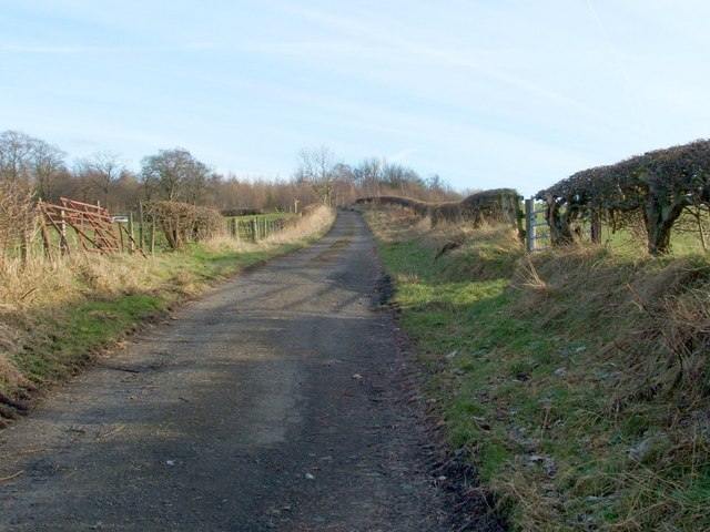
The statement quantifies approximately 7.5 miles of core paths, 1.87 miles of wider network path and 0.9 miles of aspirational core paths; it also describes a circular walking route and recreational use of the Clyde edge. The Clyde Walkway connects to the Rotten Calder crossing and continues under the railway towards Blantyre Farm Road. A locally preserved 2006 photograph by Lairich Rig documents this route; it is shown below. A 1958 OS index-card set and 2015 RCAHMS views of the priory’s north wall are catalogued by Trove, but their image rights remain unverified. historical maps and Blantyre Priory provide further context.
The council’s 2024 Biodiversity Strategy lists both this reserve and the separate Greenhall, Milheugh and Barnhill LNR among 17 South Lanarkshire reserves, with 610 hectares in total. Blantyre also has the Cocksburn and Bellsfield habitat-connectivity planting sites identified by Clyde Climate Forest; the public project page does not establish whether either sits inside this reserve boundary. South Lanarkshire GIS metadata includes separate designated LNR, proposed LNR and LNCS feature layers, but individual Blantyre feature geometries could not be queried in this research pass. Greenhall, Milheugh and Barnhill Local Nature Reserve Cocksburn and Bellsfield community woodlands Council Biodiversity Strategy (South Lanarkshire Council: Biodiversity Strategy 2024)
The designation combines conservation, access, local history and recreation. It connects Blantyre to neighbouring settlements and habitats, but its administrative reserve boundary should not be confused with the historical parish boundary. See The historical parish of Blantyre and Low Blantyre suspension bridge and the Clyde crossings.
Clyde Walkway photograph

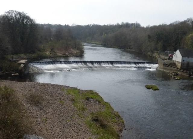
The Clyde weir
Related
- creative commons by sa 2 0 deed
-
commons clyde walkway blantyre farm road 956655
-
slc bbu lnr