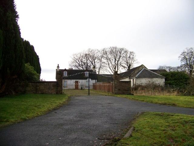
Farmstead view

Map history and surviving buildings
A 2025 cultural heritage assessment reports that Auchentibber appears on Roy's Military Survey of Scotland, indicating occupation before the widespread agricultural improvements of the later eighteenth and nineteenth centuries. The first-edition Ordnance Survey also shows structures on the farmstead footprints.
The walkover describes the surviving group as a courtyard with residential and range buildings showing different phases of construction and alteration. The report assesses the oldest fabric as late eighteenth or early nineteenth century. Trees and a small area of parkland or garden west and south-west of the buildings are shown on the 1864 OS map, with some trees surviving at the time of survey. The farmstead thus records continuity and adaptation in a working agricultural landscape, rather than one unaltered building phase.
Limestone workings in the surrounding landscape
The name Auchentibber also appears in industrial geology. The Geological Survey’s 1949 account places old quarries, mines and shafts west and south of Auchentibber within a wider district that included Calderwood, Crossbasket, Dikehead, Greenblairs and Newfield; lime-kiln remains were also recorded. A later specialist register lists infilled adits east of Calder Glen and gives approximate grid references near Auchentibber Road and Calderside Road. These are district-scale extraction records and should not be attached to the farmstead buildings themselves without map comparison. The memoir describes local limestone working mainly for fluxing, distinct from the nearby coal industry. Limestone working around Auchentibber blantyre project 1914 auchentibber geological maps Geological Survey memoir
The parish account written in 1952 looks back on the wider Auchintibber village, not just the present farmstead. Mackenzie says no new building had taken place there during the twentieth century to that date; after earlier ironstone and limestone extraction, the village gradually declined as the workings closed. He describes missing electric lighting, gas and sanitation, a one-teacher primary school with no more than eighteen pupils in recent years, and a bus to Hamilton only on Fridays and Saturdays. These are attributed mid-century observations rather than current conditions or a precise chronology for each mine. They show how a once-mineral landscape and remote transport pattern persisted as a small rural community while most parish growth concentrated elsewhere. third statistical account blantyre 1952 Blantyre population, 1755–1951 Education in Blantyre (Third Statistical Account: Parish of Blantyre (1952))
Setting and proposed change
The proposed Calderside Solar layout included a 50-metre exclusion zone around the surviving farmstead buildings to avoid direct physical effects, while the assessment predicted a moderate-to-minor adverse indirect effect on setting. These are the consultant's predictions for a proposed scheme, not evidence that the project proceeded or that its predicted effects occurred. Calderside Solar proposal and Blantyre's northern landscape calderside solar farm cultural heritage assessment